

Introduction
The Madhubani district is one of the 38 districts in the state of Bihar, India. The district gets its name from “madhu” meaning sweet and “bani” meaning voice of language. When joined together, both words mean the “land of sweet language”. (1)
It was formed from the former Darbhanga district in 1972 as part of the reorganisation of districts in the state of Bihar. Previously, this was the northern subdivision of the Darbhanga district. District is divided in five sub-divisions namely- Madhubani, Janagar, Benipatti, Jhanjharpur and Phulparas. It is made up of 21 development blocks. (2)
History
There are virtually no prehistoric sites present in the district, while remnants of the oldest aboriginal inhabitants can be found in several areas. According to Dr. Suniti Kumar Chatterji's paper titled 'Kiratajanakirti,' prior to the Aryanisation of the territory, the area appears to have been inhabited by aborigines, and Shiva worship was prevalent. (3)
Bimbisar, the founder of the Magadhan imperial authority, aspired to imperial dominance, and his son, Ajat Shatru, shared his goal. Ajat Shatru conquered North Bihar after defeating the Lichchhavis. He ceded power of Mithila to the Magadha empire. The Lichchhavis' lineage can be traced back to the days of the royal Guptas. Madhubani must have been a part of the theological and cultural turmoil that shook the people of the Gangetic Valley in the sixth century B.C. Because the teachings of two great reformers (Mahavira and Buddha) permeated the entire region of North Bihar, it is only natural to assume that the people of Madhubani actively engaged in the spread of these reform movements. (4)
If we look at the district gazettes, we get to know that Darbhanga was under the rule of the Oinwaras. Nath Thakur, the grandson of Jayapati Thakur of the Srotiya Maithil Brahmins became the first king of the region. He got his name from the local rulers of Karnat dynasty whom he served. He was rewarded with the grant of the village of Oini in recognition of his scholarship. As customs would dictate, he took the name, creating his own dynasty, Oiniwar. Dynastic capitals with this period changed rapidly. The capital was moved from Oini from the present day district of Muzaffarpur to the village of Sugauna in the present-day district of Madhubani. Hence giving rise to the rulers to be known as the Sugauna Dynasty. (5)

The next major event occurred when the British won the key battle of Buxar in 1764, giving them unrivalled control over Bengal's Lower Provinces. As a result, Madhubani, along with other sections of Bihar, came under British rule. In 1857, patriotic fervour was high in Madhubani district, as it was in many other districts throughout Bihar. (6)
Later, the call of the non-cooperation movement was met with a strong reaction in the Madhubani district, and many people volunteered to serve the cause championed by Mahatma Gandhi. Khadi spinning and weaving were made mandatory for congress workers. Madhubani now has a Khadi centre. It gradually increased its operations. Khadi became immensely popular, and Madhubani quickly established itself as a renowned centre of Khadi production. The popularity of Khadi weaving and spinning in the neighbourhood helped to inspire people to support the nationalist cause. Madhubani district was crucial in the country's freedom war.(7)
Geography, Climate & Demographics
Encompassing an area of 3,501 sq km, the Madhubani district is bounded on the north by a Nepalese hill region and extends to the border of its parent district Darbhanga in the south, Sitamarhi in the west, and Supaul in the east, fairly represents the centre of the territory once known as Mithila, and the district has maintained its own distinct individuality. Currently, the district headquarters lie in Madhubani town.(8)

According to the 2011 census, the total population of 4,487,379 as per the Census 2011. Out of which 2,329,313 are males while 2,158,066 are females. The average sex ratio of Madhubani district is 938 females for every 100 males. As per Census 2011 out of total population, 3.6% people live in Urban areas while 96.4% live in the Rural areas. The average literacy rate in urban areas is 71.1% while that in rural areas is 58.1%. The total literacy rate of Madhubani district is 58.62%. The male literacy rate is 57.53% and the female literacy rate is 37.78% in Madhubani district. As per the 2011 census, the major religions practised in the district were Hinduism (81.39%) and Islam (18.25%). Along with that, the principal languages spoken were Maithili (84.07%) and Urdu (12.86%).(9)
The climate here is mild, and generally warm and temperate. Summer starts here at the end of June and ends in September. There are the months of summer: June, July, August, September. The month with the highest relative humidity is September (84.08 %). The month with the lowest relative humidity is April (39.92 %). The month with the highest number of rainy days is July (27.30 days). The month with the lowest number of rainy days is December (0.70 days).(10)
Tourism & Art
In terms of tourism, the district has many well known historical and religious sites. Saurath, a village situated near Madhubani-Jaynagar is known for the Somnath Mahadev temple. Kapileswarsthan, a village located 9 km away from the district is famous for its Shiva temple. Uchaitha village in Benipatti block is famous for the Bhagwati temple on the western banks of the Thumne River and it is associated with the legendary poet Kalidasa. Lastly, the Ugaranath temple in Bhawanipur village is also a centre of attraction and is associated closely with the prominent poet, Vidyapati. (11)

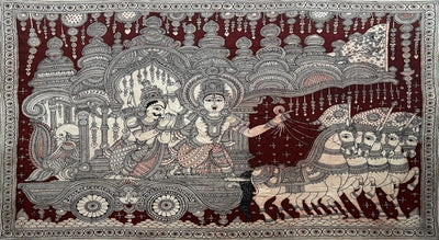
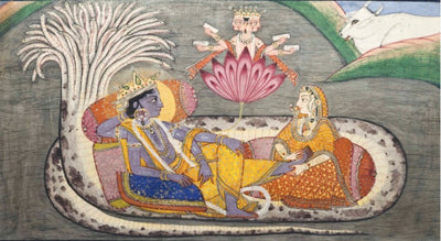
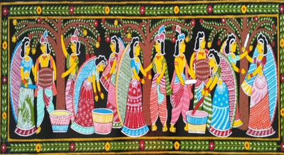
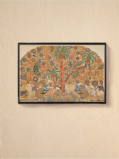
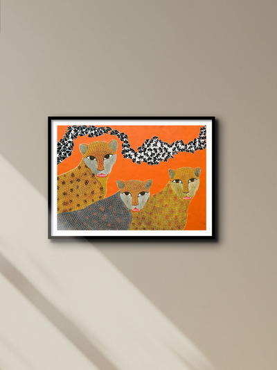
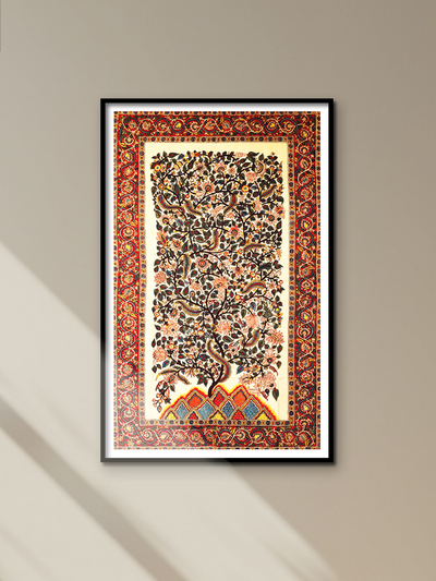
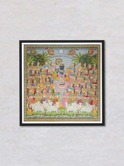
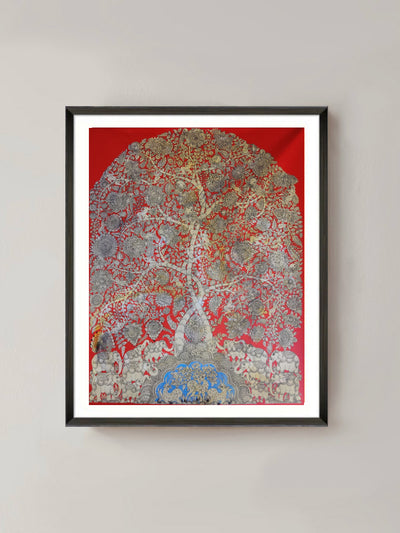
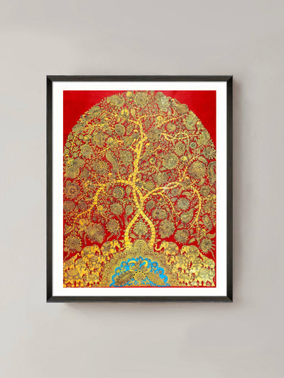
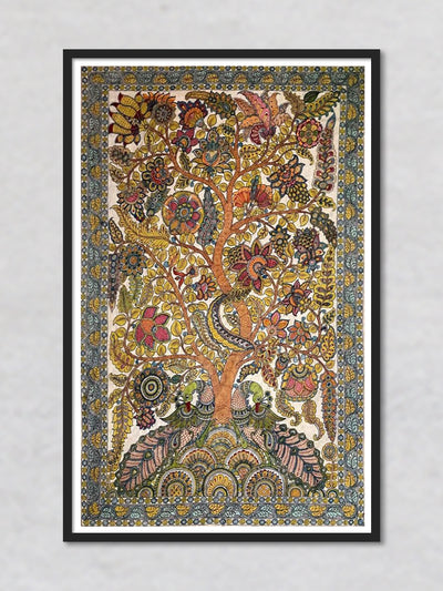
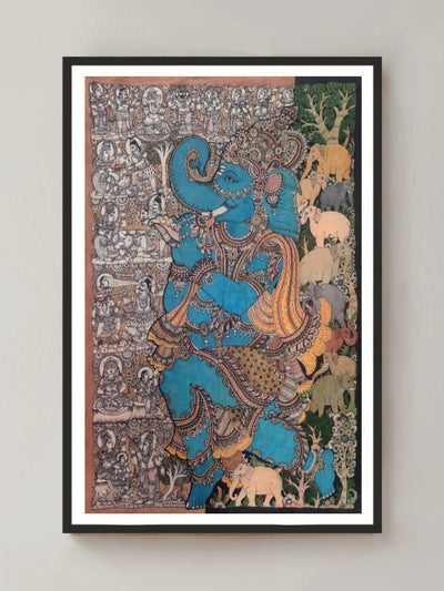
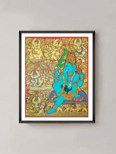
Apart from religious sites, the district is also extremely famous for the production of Madhubani paintings located at the Madhubani town. Madhubani art dates back many hundred years and was first commissioned by King Janak for his daughter's wedding to Lord Rama.
Madhubani art was traditionally practised only by Madhubani women on mud walls, but it is now being practised on cotton textiles, canvas, and handmade paper. This popular Mithila area art displays the region's people's inventiveness and compassion. Like any folk art, it represents the psychology of the culture to which it belongs; it reflects the region's morals, values, and customs in an intriguing way. This ancient art is created with fingers, twigs, brushes, nib-pens, and matchsticks, as well as natural dyes and pigments, and is distinguished by eye-catching geometrical designs. These paintings are mostly created by women in the Mithila region, in a male-dominated society. Through the years, Madhubani art and paintings have evolved, grown and spread across the world, finding an audience wherever it has gone.(12)
Development, Economics and Politics
Development, economy and politics are interlinked together in the functioning of the district and eventually the state. Throughout the state of Bihar, the last 5-10 years have showcased sluggish growth, poor urbanisation, little-to-no investment and vast amounts of human out-migration to other states in the country.
Predominantly, Madhubani district is famous for the production of Madhubani paintings. Along with that, the majority of the population is dependent on farming, directly or indirectly. Rice mills and timber factories also play an important role in the economy of the region. Agriculture, along with animal husbandry and Makhana is the main economic activity. Industrial activities are confined primarily to micro enterprises and in the food processing and services sector is emerging economic activity. But at the same time, the Ministry of Panchayati Raj in 2006 has named the district as the country's 250 most “backward” districts thus receiving funds from the Backward Regions Grant Fund Programme.(13)
Social infrastructure such as health and education, as well as support infrastructure such as shelter, sanitation, power, telephone, and road connectivity, can help to humanise economic progress. Indeed, the lack of infrastructure is positively associated with the prevalence of poverty. Studies have also indicated a positive relationship between the level of economic development and accessibility of quality housing which includes proper sanitation, safe drinking water and electricity. But in the district as well in the state of Bihar, it is being noticed that the state is performing extremely poorly. (14)
The state and district is also struggling with basic amenities such as the creation of proper road networks. Road networks are seen as a benchmark of progress. The denser the road network, the easier it is for people to connect, invest and trade within the area. Thus leading to higher economic activity and industrial development. (15) The Bihar Chamber of Commerce (BCC) reports that the state lacks infrastructure to attract investors. Amit Mukherjee, Secretary General of BCC says that(16),
“The overall industrial environment is not impressive in Bihar. Developing industrial corridors requires wide roads not less than 6-lane but we hardly have 6-lane roads in Bihar.”
According to the RBI’s Handbook of Statistics on Indian States (2018-2019), it has been found that Bihar that the total length of state highways built has been 4,006 km in comparison to other states such as Uttar Pradesh (7,201km), Odisha (4,139km), Madhya Pradesh (11,389km).(17)
Meagre investment due to lack of basic infrastructure such as sanitation, road networks, internet access etc has created lesser opportunities for people within the state to be employed thus creating a massive human migration to different parts of the country for employment especially Delhi, Jharkhand, West Bengal, Maharashtra, Uttar Pradesh, Haryana, and Punjab. It is reported that more that 55% of the male migrants leave to find work.(18)
Given the state's general economic woes, the causes for the increased phenomena of out-migration are not difficult to understand (19) -
- Despite the richness of water resources and the great fertility of the soil, the state produces virtually little agricultural output. The state's disproportionately large reliance on agriculture, which employs about 80 percent of its workforce, as well as the extreme fragmentation of land holdings and relatively high landlessness among peasants, are major barriers to agricultural output.(20)
- High population growth has aggravated the situation, putting unsustainable strain on land and forcing forced migration for survival.(21)
- On the other hand, there are few job opportunities in the industrial sector, which refuses to establish roots in the state. Despite potential, there are few takers in what is believed to be an unfavourable industrial climate. (22)
- Large shortfalls in physical and social infrastructure, weak financial markets and limited access to credit, a scarcity of skilled labour, major worries about security and law and order, and red tape have all contributed to low investment levels.(23)
Another massive problem faced by the state and district is that it is prone to floods. Since independence, floods in the region have affected 2.24 million hectares of agricultural land in all and precipitated losses worth Rs 768.38 crore between 1953-2017.(24) According to the Bihar Disaster Management Authority (BSDMA), floods have affected approximately 73.63 percent of the whole geographical area of North Bihar. Almost every year, floods destroy life, infrastructure, and agriculture in North Bihar. Darbhanga, Madhubani, Supaul, Saharsa, Madhepura, Khagaria, Muzaffarpur, and other districts in North Bihar are frequently flooded.(25)
Rivers from Nepal are the primary cause of flooding in Bihar. During the Monsoon season, Nepal receives exceptionally significant rainfall, which causes an increase in the water level of these rivers, which generally become overloaded and hence floods occur in the basin (in North Bihar). One of the main culprits is Nepal's Koshi Barrage, which must be opened when the river is overflowing, causing flooding in Supaul and other districts in its basin.(26)
In response, former Chief Minister Nitish Kumar stated that "he is doing all possible to improve the Koshi region." He further stated that the necessary steps were being taken to protect people living between the Western Koshi embankment and the Koshi river from recurring floods while addressing a public meeting at the premises of Jagdeo Salauta High School in Bariyarva village under Madhepur block of Madhubani district after laying foundation stones for seven works under the Western Koshi Canal Project.(27)

References
-
Government of Bihar. n.d. History|District Madhubani, Government of Bihar | India. [online] Available at: <https://madhubani.nic.in/history/>.
-
Government of Bihar. n.d. History|District Madhubani, Government of Bihar | India. [online] Available at: <https://madhubani.nic.in/history/>.
-
Government of Bihar. n.d. History|District Madhubani, Government of Bihar | India. [online] Available at: <https://madhubani.nic.in/history/>.
-
Government of Bihar. n.d. History|District Madhubani, Government of Bihar | India. [online] Available at: <https://madhubani.nic.in/history/>.
-
En.wikipedia.org. n.d. Oiniwar Dynasty - Wikipedia. [online] Available at: <https://en.wikipedia.org/wiki/Oiniwar_Dynasty>.
-
Government of Bihar. n.d. History|District Madhubani, Government of Bihar | India. [online] Available at: <https://madhubani.nic.in/history/>.
-
Government of Bihar. n.d. History|District Madhubani, Government of Bihar | India. [online] Available at: <https://madhubani.nic.in/history/>.
-
Indiastatdistricts.com. n.d. DistrictsOfIndia- Socio-economic statistical data of Madhubani District, Bihar. [online] Available at: <https://www.indiastatdistricts.com/bihar/madhubani-district#:~:text=Agriculture%20is%20the%20backbone%20of,subsidiary%20occupation%20of%20the%20district.>.
-
En.climate-data.org. n.d. Madhubani climate: Average Temperature, weather by month, Madhubani weather averages - Climate-Data.org. [online] Available at: <https://en.climate-data.org/asia/india/bihar/madhubani-55194/>.
-
Government of Bihar. n.d. Tourism| District Madhubani, Government of Bihar | India. [online] Available at: <https://madhubani.nic.in/tourism/>.
-
Bahadur Singh, C., 2020. Madhubani Paintings: People’s Living Cultural Heritage. [online] World History Encyclopedia. Available at: <https://www.worldhistory.org/article/1527/madhubani-paintings-peoples-living-cultural-herita/>.
-
En.wikipedia.org. n.d. Madhubani art - Wikipedia. [online] Available at: <https://en.wikipedia.org/wiki/Madhubani_art>.
-
En.wikipedia.org. n.d. Madhubani district - Wikipedia. [online] Available at: <https://en.wikipedia.org/wiki/Madhubani_district>.
-
Indiastatdistricts.com. n.d. DistrictsOfIndia- Socio-economic statistical data of Madhubani District, Bihar. [online] Available at: <https://www.indiastatdistricts.com/bihar/madhubani-district#:~:text=Agriculture%20is%20the%20backbone%20of,subsidiary%20occupation%20of%20the%20district.>.
-
Ghose, D., 2020. Infrastructural Constraints of Development in Bihar. [ebook] Patna, India: Patna Women's College. Available at: <https://www.researchgate.net/publication/340600472_Infrastructural_Constraints_of_Development_in_Bihar>.
-
Ghose, D., 2020. Infrastructural Constraints of Development in Bihar. [ebook] Patna, India: Patna Women's College. Available at: <https://www.researchgate.net/publication/340600472_Infrastructural_Constraints_of_Development_in_Bihar>.
-
National Herald. 2020. ‘Bihar lacking basic infrastructures to attract investors’. [online] Available at: <https://www.nationalheraldindia.com/national/bihar-lacking-basic-infrastructures-to-attract-investors> .
-
Vikram, K., 2020. Beyond politics: Bihar scores poorly on various infrastructure parameters ahead of polls. [online] The New Indian Express. Available at: <https://www.newindianexpress.com/thesundaystandard/2020/oct/25/beyond-politics-bihar-scores-poorly-onvarious-infrastructure-parameters-ahead-of-polls-2214668.html>.
-
Jha, R., 2022. Speeding up Bihar’s urbanisation. [online] Observer Research Foundation. Available at: <https://www.orfonline.org/expert-speak/speeding-up-bihars-urbanisation/>.
-
Jha, R., 2022. Speeding up Bihar’s urbanisation. [online] Observer Research Foundation. Available at: <https://www.orfonline.org/expert-speak/speeding-up-bihars-urbanisation/>.
-
Jha, R., 2022. Speeding up Bihar’s urbanisation. [online] Observer Research Foundation. Available at: <https://www.orfonline.org/expert-speak/speeding-up-bihars-urbanisation/>.
-
Jha, R., 2022. Speeding up Bihar’s urbanisation. [online] Observer Research Foundation. Available at: <https://www.orfonline.org/expert-speak/speeding-up-bihars-urbanisation/>.
-
Jha, R., 2022. Speeding up Bihar’s urbanisation. [online] Observer Research Foundation. Available at: <https://www.orfonline.org/expert-speak/speeding-up-bihars-urbanisation/>.
-
Jha, R., 2022. Speeding up Bihar’s urbanisation. [online] Observer Research Foundation. Available at: <https://www.orfonline.org/expert-speak/speeding-up-bihars-urbanisation/>.
-
Singh, M., 2020. Floods in Bihar Destroyed 7.54 Lakh Hectares of Agricultural Land This Year. [online] The Wire. Available at: <https://thewire.in/environment/floods-bihar-agricultural-land>.
-
Deo, A., 2020. Flood Problems of Bihar and their Possible Solutions. [online] CSE Junction. Available at: <https://www.csejunction.com/2020/08/flood-problems-of-bihar-and-their.html>.
-
Deo, A., 2020. Flood Problems of Bihar and their Possible Solutions. [online] CSE Junction. Available at: <https://www.csejunction.com/2020/08/flood-problems-of-bihar-and-their.html>.
-
Kumar, M., 2019. Bihar CM lays foundation stones for seven projects in Madhubani district | Patna News - Times of India. [online] The Times of India. Available at: <https://timesofindia.indiatimes.com/city/patna/madhubani-bihar-cm-lays-foundation-stones-for-seven-projects/articleshow/72087490.cms>.


Great Article , very informative.
Very nicely written and informative as well. Good work